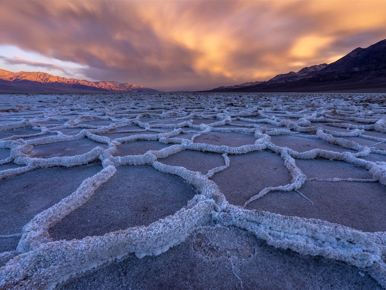
Badwater Basin
This salt flat sits 282 feet below sea level, representing the lowest point in North America. Visitors can walk out onto the salt crust to view the crystalline patterns.
Walk one mile out to see the salt polygons clearly.

Death Valley National Park sits roughly 290 miles northeast of Los Angeles, positioned across the Mojave Desert and the Panamint Range. The journey requires careful route selection and an understanding of desert driving conditions, particularly during summer months when pavement temperatures can disable unprepared vehicles.
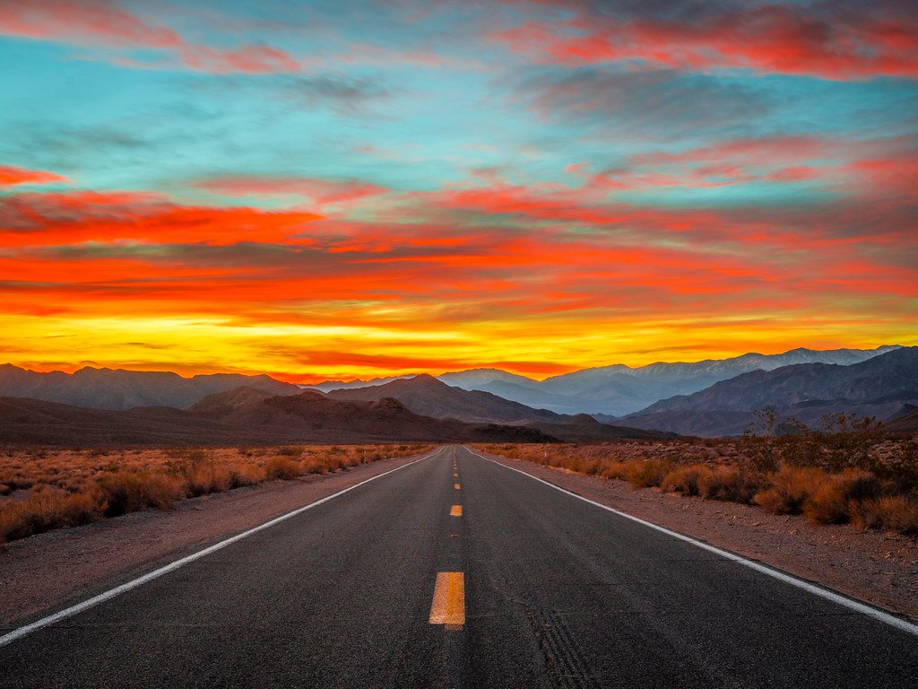
Quick answer
Death Valley lies approximately 290 miles from Los Angeles via Interstate 15 and California State Route 127, translating to 4.5 to 5 hours of driving under normal conditions. The route crosses the Mojave Desert and climbs through mountain passes before descending into the valley floor at 282 feet below sea level. Travel time increases during summer heat advisories and holiday weekends when park visitation peaks.
The Panamint Range creates a rain shadow so effective that Death Valley receives less than two inches of annual precipitation, making it the driest place in North America. That geological fact shapes every aspect of planning the Los Angeles to Death Valley drive, from fuel stops to emergency water supplies. The distance from Los Angeles to the park's eastern boundary measures roughly 290 miles, but reaching specific destinations within the 3.4-million-acre park adds considerable mileage. Furnace Creek, the primary visitor hub, sits 305 miles from downtown LA via the I-15 and CA-127 corridor. Badwater Basin, the continent's lowest elevation point at 282 feet below sea level, requires an additional 17 miles south of Furnace Creek. Zabriskie Point and Dante's View, both essential viewpoints, branch off the main valley road and demand extra driving time on winding mountain routes. Two primary corridors serve Los Angeles drivers. The northern route follows Interstate 15 through Barstow, then cuts east on CA-127 through the town of Baker before entering the park near Shoshone. This path offers reliable fuel stops and cell coverage until Baker, the last full-service town before a 90-mile stretch of open desert. The southern route via Interstate 10 and CA-178 through Ridgecrest adds 30 minutes but provides access to the park's western entrance and Panamint Springs, useful for visitors combining Death Valley with stops in the Eastern Sierra. Summer temperatures on the valley floor regularly exceed 120°F, forcing the National Park Service to issue heat advisories that recommend against hiking after 10:00 AM. Winter months bring moderate daytime temperatures in the 60s and 70s, though nighttime lows can drop below freezing at higher elevations like Telescope Peak. Spring wildflower blooms, triggered by rare winter rains, draw peak visitation between mid-February and late March. The park remains open 24 hours daily year-round, with the entrance fee of 30 USD covering seven consecutive days of access. Cellular service vanishes beyond Baker, and the park's extreme topography blocks signals in most valley locations. Visitors should download offline maps, carry physical backup navigation, and inform someone outside the park of their itinerary and expected return time.
“The Panamint Range creates a rain shadow so effective that Death Valley receives less than two inches of annual precipitation, making it the driest place in North America.”
Death Valley National Park is located approximately 250 to 300 miles northeast of Los Angeles, depending on your specific departure point. The most direct approach for visitors driving from the Los Angeles area is via Interstate 15 and State Route 127.
I-15 N to CA-127 N and CA-190 W
I-5 N to CA-14 N and US-395 N
To ensure a smooth entry, plan your arrival between 06:00 and 09:00. This window helps you avoid extreme heat and heavy mid-day crowds when accessing the park.
Death Valley National Park remains accessible to visitors throughout the entire week. The park grounds are open to the public daily.
Upon arrival, visitors can explore diverse geological formations and basins that define the park landscape. These locations offer access to the unique desert environment.
This salt flat sits 282 feet below sea level, representing the lowest point in North America. Visitors can walk out onto the salt crust to view the crystalline patterns.
Walk one mile out to see the salt polygons clearly.
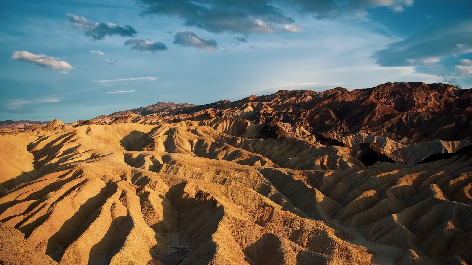
This site features an expanse of golden, rippled badlands formed by dried lake sediments. It provides elevated views of the surrounding mountains and canyons.
Visit at sunrise to photograph the changing light on ridges.
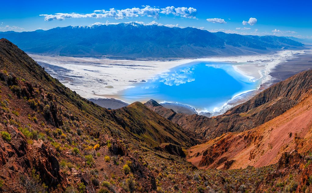
Located high in the Black Mountains, this overlook provides a panoramic perspective of the entire Death Valley basin. It offers a cooler vantage point due to its high elevation.
Identify the salt flats and Telescope Peak from above.
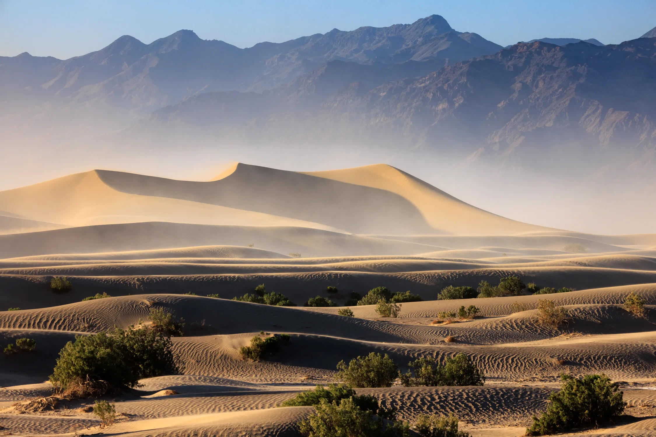
These dunes cover a large area and reach up to 100 feet in height. They are composed of quartz and feldspar grains carried by wind.
Hike to the highest dunes for fewer footprints in sand.
Prepare for extreme desert conditions and remote driving when planning your visit from Los Angeles.
Everything you need to know about how far is death valley from los angeles
The driving distance to reach Death Valley National Park from Los Angeles is typically between 250 and 300 miles depending on your specific route. Knowing how far is death valley from los angeles helps you better prepare for the desert environment. Visitors should anticipate a journey lasting approximately four to five hours by car. Because of the vast distances in the Mojave Desert, planning your departure is essential. When researching how far is death valley from los angeles, consider that traffic leaving the city can significantly impact travel times. Professional shuttle services often provide a structured Los Angeles to Death Valley tour for those who prefer not to drive. To avoid extreme heat and heavy mid-day crowds, the best arrival window is between 06:00 and 09:00. This schedule allows for a more comfortable exploration of the basin and salt flats. The standard entrance fee is 30 USD per private vehicle, which remains valid for a duration of 7 days. This fee supports the maintenance of park trails and visitor facilities. The park operates on a 24-hour schedule, meaning it is open from 00:00 to 23:59 every day of the week. This accessibility allows for flexible stargazing or early morning photography sessions. Many travelers ask how far is death valley from los angeles while looking to explore broader Southern California landmarks like the Sierra Nevada mountains or Joshua Tree. Coordinating your transit is a key part of your itinerary logistics. A common mistake is failing to account for extreme temperatures and limited cell service within the park boundaries. Always bring extra water and ensure your vehicle is prepared for high-temperature terrain.